- Home
- The Carolina Lowcountry and the Atlantic World
- religion
- history
- Religion, Space, and the Atlantic World

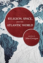
Religion, Space, and the Atlantic World
Edited by: John Corrigan
Series: The Carolina Lowcountry and the Atlantic World
384 Pages
- Hardcover
- ISBN: 9781611177961
- Published By: University of South Carolina Press
- Published: November 2017
$71.99
In Religion, Space and the Atlantic World, editor John Corrigan makes a case for the “spatial-turn” in the field of religious studies. Corrigan asserts that while other academic fields and disciplines have incorporated spatial thinking and geography in their canons, the humanities and in particular, religious studies, have not availed themselves of the contributions made by geographers and geographic data.
Drawing on the theories of Michel de Certau, Corrigan urges that what matters is “the interrelationship of physical geography (built and unbuilt environment), social structuration (such as economic or gender orders), actor’s conceptualizations of place and space, and the purposeful of experimental activity of humans as they move physically in space” (19). Spatial thinking “provides a clearer understanding of the physical exercise of power in religion and conceptual formation of space and its representation in religion” (20).
For Corrigan, geography is important because “geographical research accomplished in recent decades has amounted to a hothouse of ideas ripe for transplantation into neighboring academic vineyards of humanities” (15). Advances in Geographic Information Systems (GIS) technology have opened up new ways of thinking about space, which can be applied to the study of religion and deliver new insights.
Corrigan rightly notes that for too long spatial thinking in religious studies has been limited to the framework long provided by Mircea Eliade of “sacred and profane spaces” (17). To challenge this traditional way of thinking, Corrigan has compiled a variety of articles that demonstrate the integration of spatial thinking with the field of religious studies. The scope of these articles is limited to the Atlantic world (loosely defined), and they urge the reader to question the conventionally understood boundaries of the Atlantic world as an area of study. To demonstrate this, Corrigan divides his anthology into four thematic sections: (1) Maps, (2) Distance, (3) Design, and (4) Identity, with each article in each section demonstrating how these four aspects of spatial thinking have opened up new insights in the field of religious studies.
Maps: In her riveting analysis of the freed slave Thomas Equaino’s autobiography, Elizabeth Maddock Dillon ingeniously combines textual analysis with GIS to demonstrate the frequency with which specific words are used in certain places at different times in Equiano’s account of his own life. The result is a series of powerfully emotional spatial maps, linking geography to human emotion. George Edward Milne traces the dynamics between clerics, cartographers and kingly power in France to document the rise of cartography as a respected profession. The desire for accurate representation of hydrography data gathered by clerics in the “new world” turns cartography from an obscure artisan tradition to an instrument of hegemony for the French state and the colonial project.
In addition, Kyle B. Roberts looks at the physical presence of many religious and secular institutions to geographically demarcate with GIS the shifting zones of influence of various religious communities in New York City. For Roberts, “spatial humanities and mapping provide scholars with a powerful means to visualize and analyze the influence of religion on the development of a city” (77). The reader is thus able to explore how cartographic technologies are not always limited to technical geographic analysis, but to readings that allow users and researchers to spatially map connections in ways that were not apparent before.
Distance: Luca Codignola points out that the concept of distance is highly subjective according to the objective of those noting it. For Jesuits traveling to and from missions, distance was not measured in time and space, but rather in terms of conversion and the long process of “saving” of souls. Similarly, Brandon Marriott, demonstrates how “foreignness” and distance were bridged by Puritan and Sephardic communities, with a popular narrative that claimed the Indigenous peoples of the Americas were actually long-lost members of “Lost Tribes of Israel.” The new world was thus biblically linked to the old, familiar world from which these communities came. Uniquely, Richard J. Callahan, Jr. highlights the waters of the Atlantic Ocean itself through the historical lens of the whaling industry. Whaling ships were both sites of religious influence for eager missionaries, and sites of religious expression for workers describing their uncontrollable fate and/or good fortunes in devotional language. Callahan also notes that whaling ships took people to places far beyond the Atlantic world, linking it with the Pacific and beyond. For each of these authors distance is not only physical, but also, a state of mind.
Design: Steven A. Wernke and Lauren E. Kohut trace the trajectory of Catholic missions in the Peruvian highlands and demonstrate using GIS network analysis techniques how evangelization was a two-step spatial process that first repurposed existing Indian ritual sites and settlements, and later required the development of entirely new sites for the purpose of religious surveillance of the colonized population. Alternately, as Jan Noel shows, Catholic convents provided relative spatial freedom for nuns in Quebec and Louisiana, as they became formidable urban institutions, providing essential services all the while maintaining significant local landholdings and local economic power. Sing D’Arcy traces the architectural development of iglesia-salon, or the “church-hall” from the Spanish reconquest of Islamic Spain and how it influenced the Spanish conquest of the Americas particularly with regards to cathedral design. Each of these articles highlight how even small changes in design to physical religious structures are imbued with religious agenda and meaning.
Identity: Todd Webb untangles the dilemma of identity for early Canadian Methodists, caught between the influences of traditional British Wesleyan Methodism and the potentially radical influence American Methodism. Similarly, Elizabeth Lewis Pardoe notes how the ethnically diverse reality of Lutheran practice in America from 1698 to 1748 was a cause of concern for Lutheran missionaries newly arrived from Europe. Heather Miyano Kopelson traces the complex spatial dynamics of Puritan identity in early Massachusetts, Rhode Island and Bermuda showing both the similarities and differences in each place and how they were shaped by England, contact with Native communities, and realities of the African slave trade. Each of these articles show how migration across the Atlantic Ocean disrupted formerly presumed static religious identities.
In the opening to his volume Religion, Space and the Atlantic World, Corrigan notes that “spatial thinking is not a sideline to other kinds of thinking but is closely interwoven with them, playing a crucial role in the human practice of world-making through the mental production, organization, archiving, and alteration of knowledge” (1). It remains to be seen however, whether an awareness of this will encourage religious studies scholars to draw upon geographic data and research techniques. While each of the articles in this volume employ a type of spatial thinking, particularly enlightening in this volume are those that have combined traditional research methods with GIS technologies to tell us something about the lives of the faithful that were not known before.
Salma Ahmad is an Independent Scholar and land-use planner.
Salma AhmadDate Of Review:September 4, 2020
John Corrigan is Lucius Moody Bristol Distinguished Professor of Religion and Professor of History at Florida State University. His previous books on the spatial humanities, all coedited with David Bodenhamer and Trevor Harris, include The Spatial Humanities: GIS and the Future of Humanities Scholarship, Deep Maps and Spatial Narratives, and the forthcoming Making Deep Maps: Foundations, Approaches, and Methods. Corrigan is the editor in chief of the Oxford Encyclopedia of American Religion.


